Explore the Map of Roman Roads in Britain - Learning Activity for Kids
- Jul 28, 2025
- 2 min read
Do We Still Use Roman Roads Today?
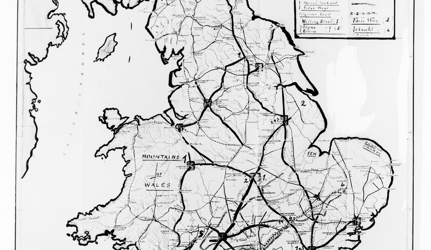
Check out the maps of the UK with ancient Roman roads plotted on them in the gallery below. By comparing it to the modern-day road map of the UK, can you spot any Roman roads that are still in use today? You could also use Google Maps to spot the modern day roads more clearly. Are these Roman roads now used as small A-numbered roads and B-numbered roads or are they big motorways (M-numbered roads)?
Have you Travelled on a Roman Road?
Exploring the Roman maps below, can you find some locations that are familiar to you? Perhaps you can find where you live, the location of your school or where you've been on holiday. Have a look at the Roman roads around these locations, are the Roman roads still in use today on the modern map? Have you been on a Roman road and not even realised it? Do you travel regularly on a Roman road near your home?
Can you Plan a Journey Using the Roman Road Map?
Using only Roman roads that are still in use today, can you plan a journey across the country? Perhaps you could plan a journey on roads going from your house to a relatives house? Or from one side of the country to the other? Can you plan a journey from a location at the very top of the map (in the North) to a location at the very bottom of the map (in the South). Can you use Google Maps to work out how long your journey would take by car in the modern day? And how long would it take to travel this journey by foot in Roman times?